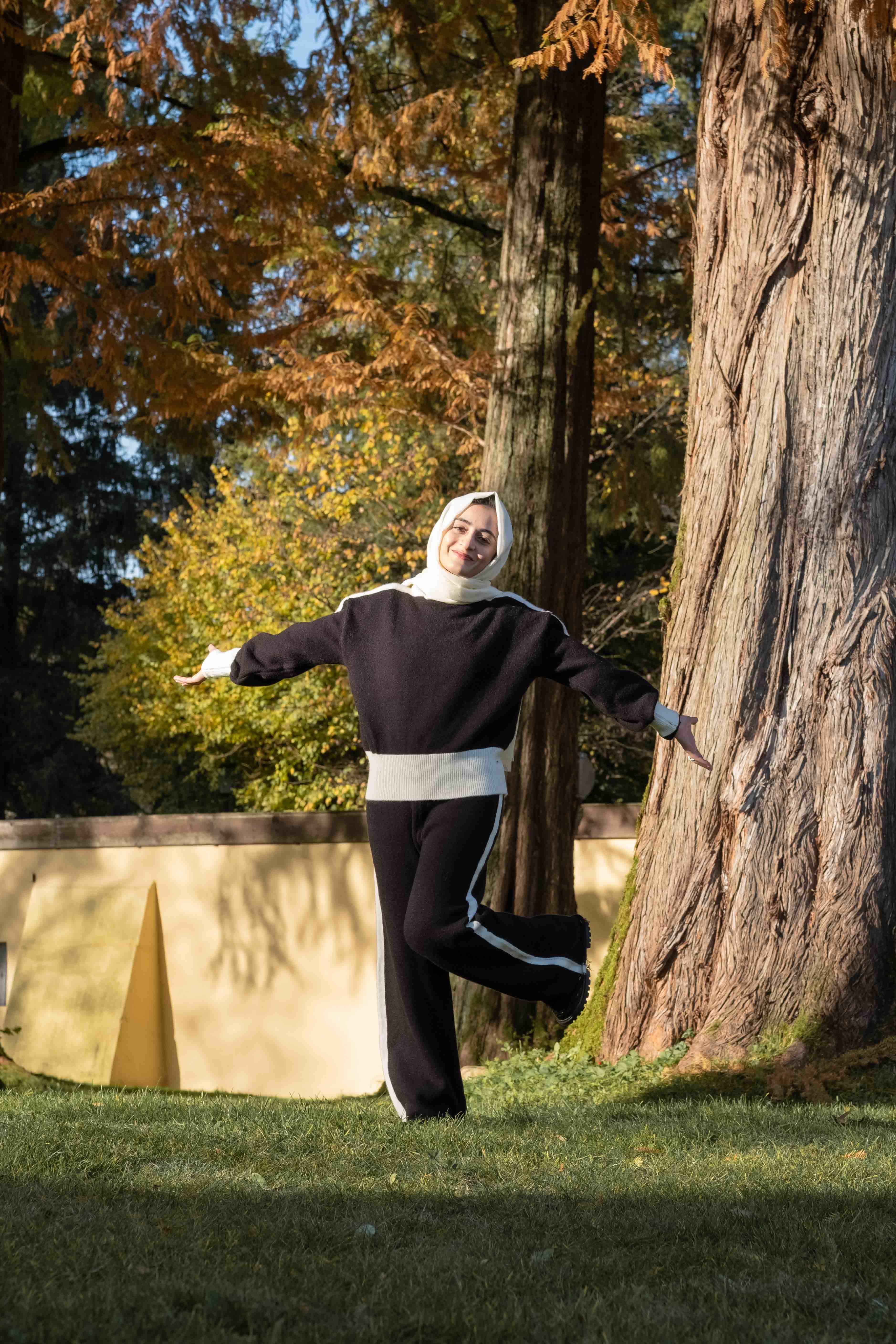
Maria Mushtaq
I'm Geo-Informatics Engineer
About
Geoinformatics Engineer and Web GIS Developer with hands-on experience in building interactive geospatial web applications. I specialize in GIS, Remote Sensing, and spatial data visualization, with a strong focus on practical, scalable solutions. Currently, I am part of the Erasmus Mundus–funded Copernicus Master in Digital Earth program.
Geo-Informatics Engineer & GIS Developer.
I design and develop interactive Web GIS applications that turn complex spatial data into practical, user-friendly solutions. Experienced in GeoServer, PostGIS, OpenLayers, Leaflet, CesiumJS, Angular, NodeJs with Express and Python (Flask), I build end-to-end geospatial systems with WMS/WFS services, esri services, spatial databases, and 2D/3D visualization. My projects include environmental risk mapping, hydrology analysis, and spatial decision-support tools. As an Erasmus Mundus–funded Copernicus Master in Digital Earth scholar, I am combining technical expertise with a strong focus on precision, scalability, and real-world impact.
- Mobile: +43 677 63480469
- Phone: +92 3127559674
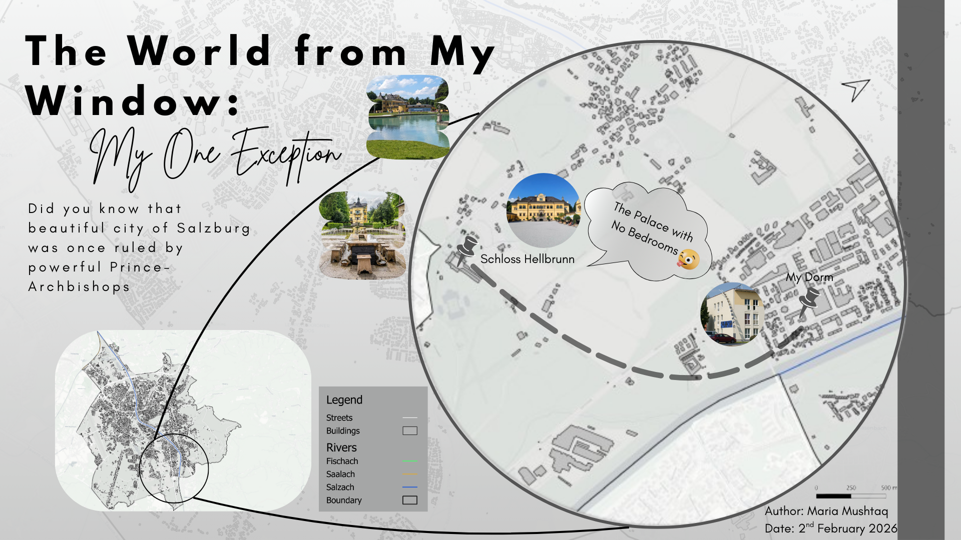
- City: Salzburg, Austria
- Degree: Master
- Email: maria.m.hashmi333@gmail.com | maria.mushtaq@stud.plus.ac.at
- LinkedIn: Maria Mushtaq
I am passionate about transforming complex spatial data into clear, usable web applications. My goal is to contribute to high-quality GIS and Web GIS products while continuing to grow as a professional in geospatial technologies and digital earth solutions.
Projects Completed
Web GIS, ML & Spatial Analysis
Years of Experience
GIS & Web GIS Development
Technologies Used
GIS, Web & Data Science
Organizations
Industry & Defense
Skills
My technical expertise spans Geospatial Technologies, Programming, Database Management, Data Analysis, and specialized Web GIS tools.
Resume
Geoinformatics Engineer and Web GIS Developer with professional experience in GIS development, spatial data analysis, and web-based geospatial systems, supported by strong academic and project-based foundations.
Summary
Maria Mushtaq
Detail-oriented Geoinformatics Engineer and Web GIS Developer with experience in building scalable geospatial applications, spatial databases, and interactive mapping tools. Strong background in GIS, Remote Sensing, Machine Learning, and Web GIS technologies.
- Salzburg, Austria
- maria.m.hashmi333@gmail.com
- 📄 Download Resume PDF
Education
Copernicus Master in Digital Earth (Erasmus Mundus)
2025 – Present
Paris Lodron Universität Salzburg, Austria
Fully Funded Erasmus Mundus Program, Europe
Advanced training in geospatial technologies, digital earth concepts, spatial data science, and web-based geospatial systems in an international academic environment.
Bachelor of Engineering – Geo-Informatics
2020 – 2024
National University of Sciences and Technology (NUST), Pakistan
Focus on GIS, Remote Sensing, spatial data analysis, machine learning applications, and geospatial web development.
Professional Experience
GIS Developer
Nov 2024 – Aug 2025
LMKR Resources, Islamabad, Pakistan
- Developing GIS-based tools and applications for environmental management and sustainable development.
- Analyzing remote sensing datasets and applying machine learning for spatial modeling and predictive analysis.
- Building spatial decision-support and risk assessment tools in collaboration with stakeholders.
Junior Software Developer (Web GIS)
Jun 2024 – Oct 2024
Inotech Solution, Rawalpindi, Pakistan
- Designed and developed scalable Web GIS architectures using GeoServer and PostgreSQL/PostGIS.
- Built interactive mapping applications using OpenLayers, Leaflet, GeoJSON, React, and Flask.
- Performed spatial data analysis and integrated remote sensing datasets into web platforms.
Geographic Information Systems Intern
Jul 2023 – Aug 2023
Government Sector, Pakistan
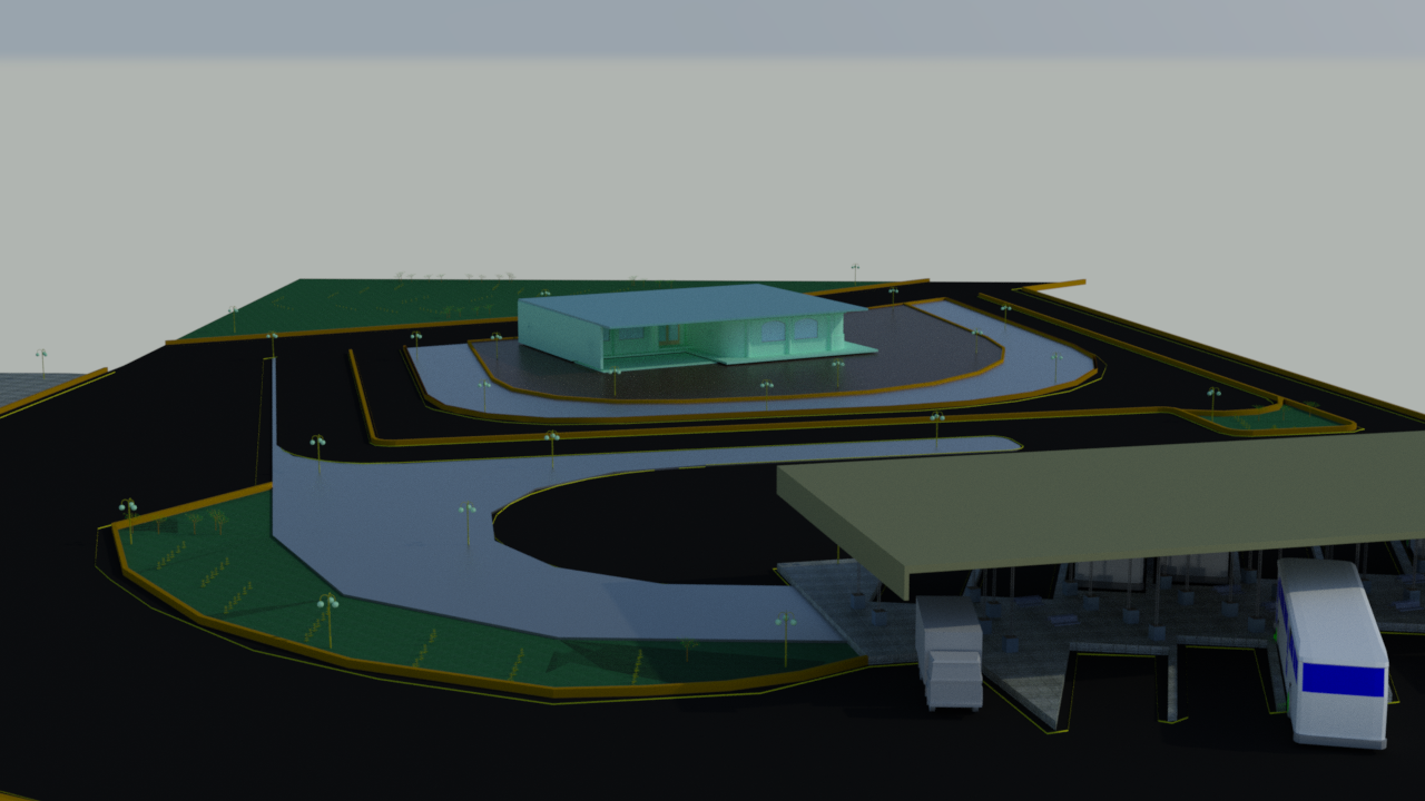
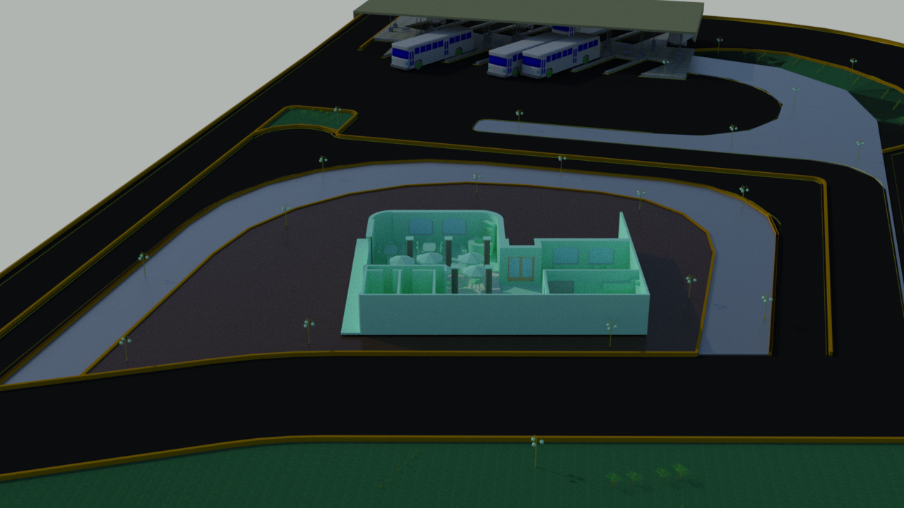
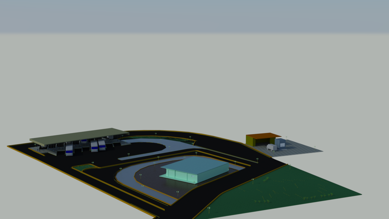
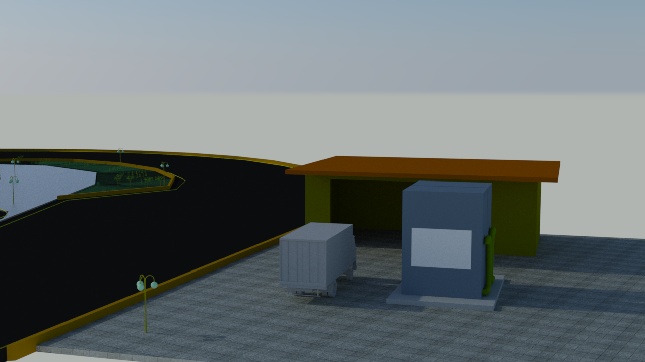
- Developed 3D web-based visualization tools using CesiumJS, including viewshed and line-of-sight analysis.
- Worked with GeoServer backend services and integrated WMS raster layers.
- Established connections between Web GIS applications and PostgreSQL databases.
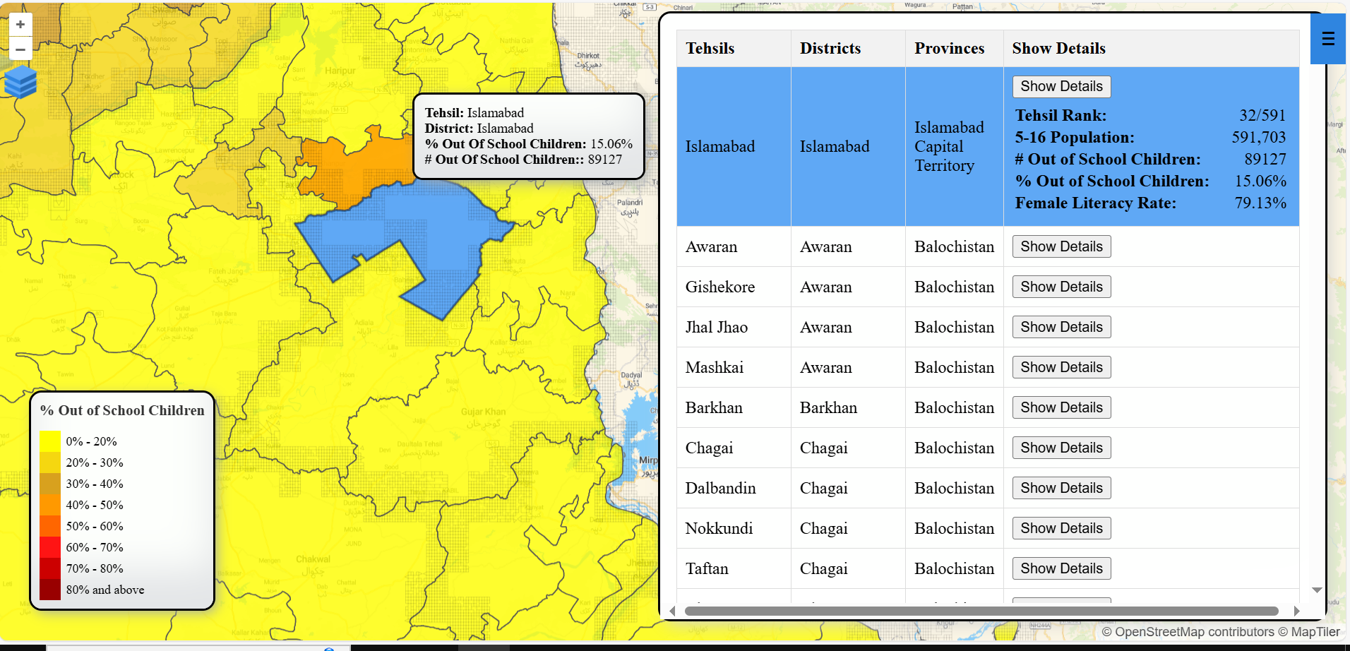
Portfolio
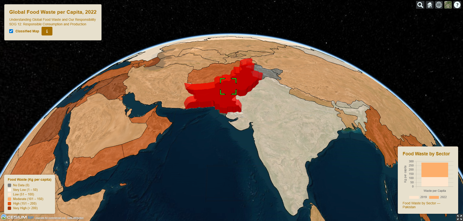
A selection of academic and professional projects in Web GIS, Remote Sensing, Machine Learning, and Spatial Data Analysis, demonstrating practical geospatial problem-solving and system development.
- All
- Web GIS
- Machine Learning
- GIS
- Remote Sensing
- Spatial Analysis
- CAD Design
- Certificates
- Cartography
Core Competencies
Applied geospatial expertise combining GIS, remote sensing, web-based mapping, and data-driven environmental analysis.
Web GIS & Interactive Mapping
Development of interactive web-based GIS applications using OpenLayers, Leaflet, CesiumJS, GeoServer, and modern web technologies.
Spatial Analysis & GIS
Advanced spatial analysis, geoprocessing, and thematic mapping using QGIS, ArcGIS, and Python-based GIS workflows.
Remote Sensing & Earth Observation
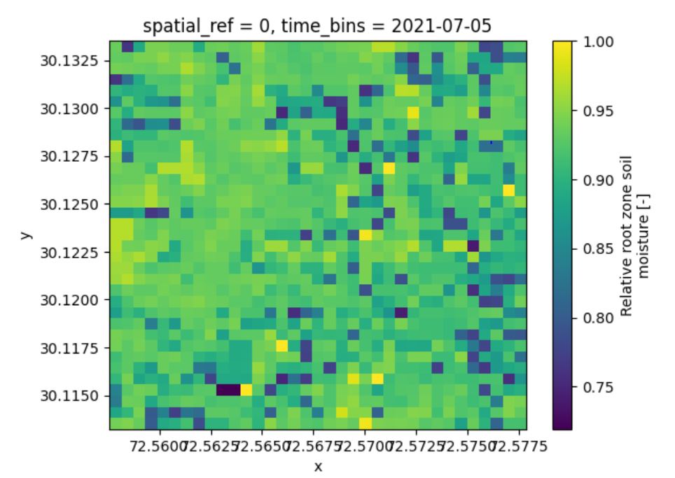
Satellite data processing and analysis using Google Earth Engine for land use, hydrology, and environmental monitoring.
Machine Learning for Geospatial Applications
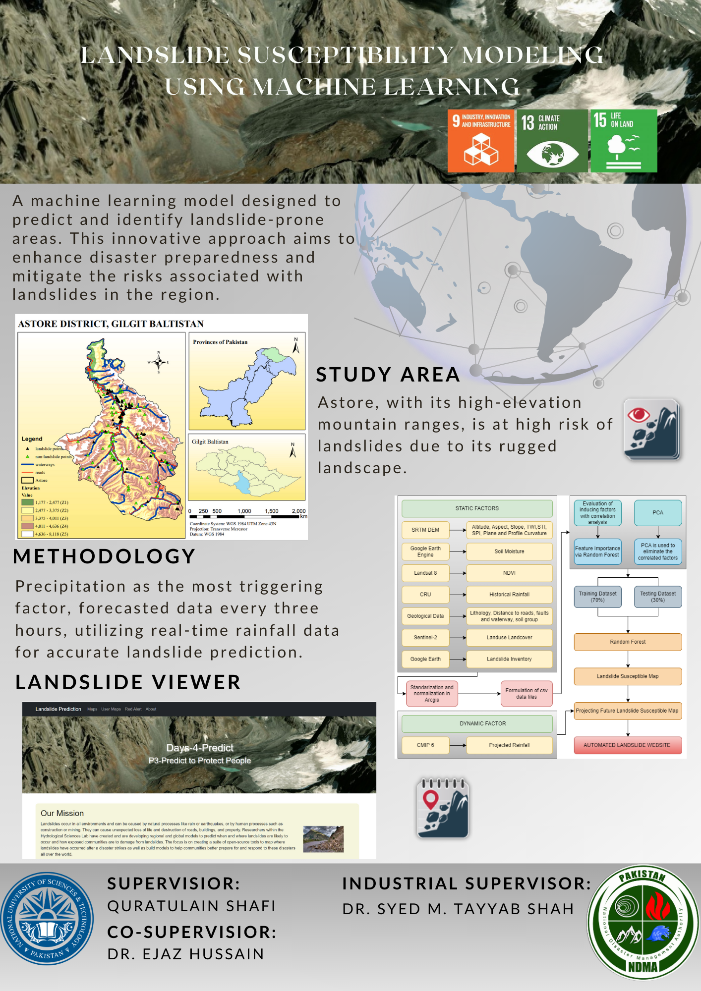
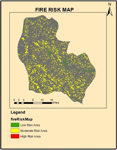
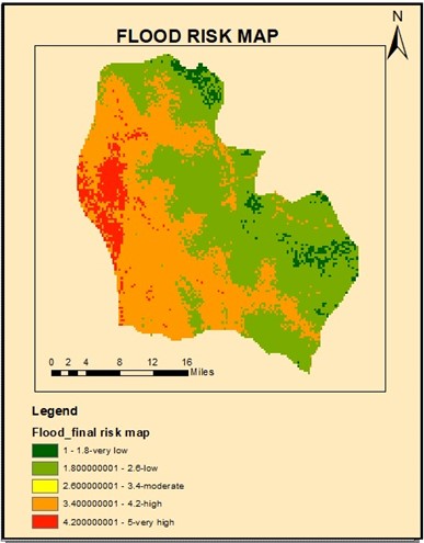
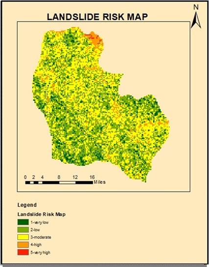
Application of machine learning techniques for landslide susceptibility mapping, risk assessment, and spatial prediction.
Spatial Databases & Backend GIS
Design and management of spatial databases using PostgreSQL/PostGIS, integrated with backend APIs using Python and Flask.
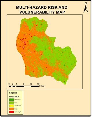
Hazard & Environmental Modeling
Experience in multi-hazard risk assessment, rainfall–runoff modeling, and environmental analysis using geospatial techniques.
Contact
I am open to new opportunities, collaborations, and connections in the geospatial field. Please feel free to reach out via email or LinkedIn for any inquiries or potential collaborations.
Address
Robert-Preußler-Straße 28, 5020 Salzburg
Call Us
+43 677 63480469
Email Us
maria.m.hashmi333@gmail.com
maria.mushtaq@stud.plus.ac.at